The Complete Guide to Climbing (by Bike)in the Southeast
To purchase - The Complete Guide to Climbing (By Bike) in the Southeast go to:
Title: The Complete Guide to Climbing (by Bike) in the Southeast
Author: John Summerson
Table of Contents
Preface . . . . . . . . . . . . . . . . . . . . . . . . . . . . . . . . . . . . . 9
Introduction . . . . . . . . . . . . . . . . . . . . . . . . . . . . . . . . . . 10
Climbing . . . . . . . . . . . . . . . . . . . . . . . . . . . . . . . . . . . . . 11
About this Guidebook . . . . . . . . . . . . . . . . . . . . . . . . . . . .14
Defining a hill climb
Definitions of Terms
Rules of the Road
Improving Climbing Ability . . . . . . . . . . . . . . . . . . . . . . . . . 24
Cycling Techniques
Specific Training for Hill Climbing
Descending
Mental Training
Climbing Tactics
Memorable Climbing Performances . . . . . . . . . . . . . . . . . . . 40
Climbs Maps . . . . . . . . . . . . . . . . . . . . . . . . . . . . . . . . . . 64
Climbs:
Alabama . . . . . . . . . . . . . . . . . . . . . . . . . . . . . . . . . . . . .71
Georgia . . . . . . . . . . . . . . . . . . . . . . . . . . . . . . . . . . . . . 73
North Carolina . . . . . . . . . . . . . . . . . . . . . . . . . . . . . . . . 81
South Carolina . . . . . . . . . . . . . . . . . . . . . . . . . . . . . . . . 103
Tennessee . . . . . . . . . . . . . . . . . . . . . . . . . . . . . . . . . . 104
Virginia . . . . . . . . . . . . . . . . . . . . . . . . . . . . . . . . . . . . . 118
West Virginia . . . . . . . . . . . . . . . . . . . . . . . . . . . . . . . . . 137
Organized Rides with Significant Climbing . . . . . . . . . . . . . . 142
Most Difficult Climbs . . . . . . . . . . . . . . . . . . . . . . . . . . . . 144
Climbing Categories . . . . . . . . . . . . . . . . . . . . . . . . . . . . 146
Climbing Resources . . . . . . . . . . . . . . . . . . . . . . . . . . . . 149
Additional Climbs Data . . . . . . . . . . . . . . . . . . . . . . . . . . 153
Climb Profiles (Top 50) . . . . . . . . . . . . . . . . . . . . . . . . . . 201
Index . . . . . . . . . . . . . . . . . . . . . . . . . . . . . . . . . . . . . 251
Selected Southeast United States Climbs:
Beech Mountain, North Carolina
____________________________________________________
Total elevation - 1,653 ft Length - 3.5 miles
Average Grade - 9.2% (17%) Rating - 1.66 (cat 1)
____________________________________________________
Beech Mountain is a difficult climb that was used as a stage finish in the now defunct Tour DuPont. Turn left on Ski Loft Rd at mile 3.1 to finish (4/10ths mile at 13%). Lance Armstrong used this hill early in his cycling recovery.
Directions - In Banner Elk, NC head west on 194 for 3/10ths mile to Beech Mountain Rd (on your right). The listed statistics start from the dip 1/4 mile down Beech Mountain Rd.
High Knob, Virginia
____________________________________________________
Total elevation - 1,577 ft Length - 3.0 miles
Average Grade - 10.0% (14%) Rating - 1.63 (cat 1)
____________________________________________________
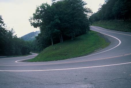
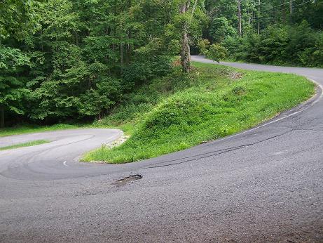
High Knob is among the steepest climbs in the Southeast U.S. The first 2 miles are the most difficult and a very narrow road gets you to its unmarked top. Several tight switchbacks will get your undivided attention but very little traffic makes this a great climb. Due to its steep grade it is a very difficult descent.
Directions - From Route 23 in Wise, Virginia exit to route 619. Head south on Route 619 for 0.2 miles where the listed climb begins. 
Lookout Mountain, Tennessee/Georgia
___________________________________________________
Total elevation - 957 ft Length - 2.9 miles
Average Grade - 6.3% (10%) Rating - 0.60 (cat 2)
___________________________________________________
This is the first of 5 routes up Lookout Mountain that begin in Tennessee. The start is steep then the route levels off before a final steep section with great views of the valley to your left. The listed climb ends at Mockingbird Lane with Rock City to your left.
Directions - In Chattanooga, TN head north on Broad St to Route 17. Head south on 17 for a short distance to Ochs Highway on the right (stoplight) to begin the climb.