The Complete Guide to Climbing (by Bike)
in Colorado
To purchase - The Complete Guide to Climbing (By Bike) in Colorado go to:
Table of Contents
Preface ……………………………………………………………………………………… 8
Introduction ………………………………………………………………………………. 9
Climbing ……………………………………………………………………………………. 11
About this Guidebook ………………………………………………………………… 13
Defining a hill climb
Definitions of Terms
Rules of the Road
Improving Climbing Ability …………………………………………………………… 24
Cycling Techniques
Specific Training for Hill Climbing
Descending
Mental Training
Climbing Tactics
Memorable Climbing Performances ……………………………………………….. 43
Climbs Map …………………………………………………………………………………. 73
Northeast ………………………………………………………………………………..... 74
Southeast ………………………………………………………………………..…….... 94
West ……………………………………………………………………………………...…116
Organized Races/Rides with Significant Climbing …………………………… 148
Most Difficult Climbs …………………………………………………………………….149
Climbing Categories
Greatest Elevation Gain Climbs
Highest Elevation Attained Climbs
Longest Climbs
Steepest Climbs
Greatest Length of 10%+ Grade Climbs
Most Technical Descents
Fastest Descents
Most Scenic Climbs
Climbing Resources ……………………………………………………………………. 160
Additional Climbs Data ……………………………………………………………….. 164
Climb Profiles …………………………………………………………………………….. 210
Index ……………………………………………………………………………………….. 232
Selected Colorado Climbs:
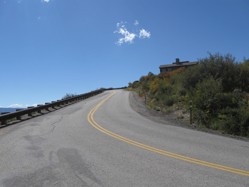
Belly Ache
________________________________________________
Total elevation - 2,066 ft Length - 5.2 miles
Average Grade - 7.5% (10%) Rating - 1.79 (cat 1)
________________________________________________
You may get one on this climb just west of Vail. Solid grade from the start, you pass a golf course down low where the grade eases a bit. The grade then increases and you enter an area of homes. Great views appear near the top and the climb ends where the pavement ends.
Directions - In Wolcott, CO on Interstate 70 take exit 157. Turn south and the climb begins at the cattle guard by continuing south up the hill.
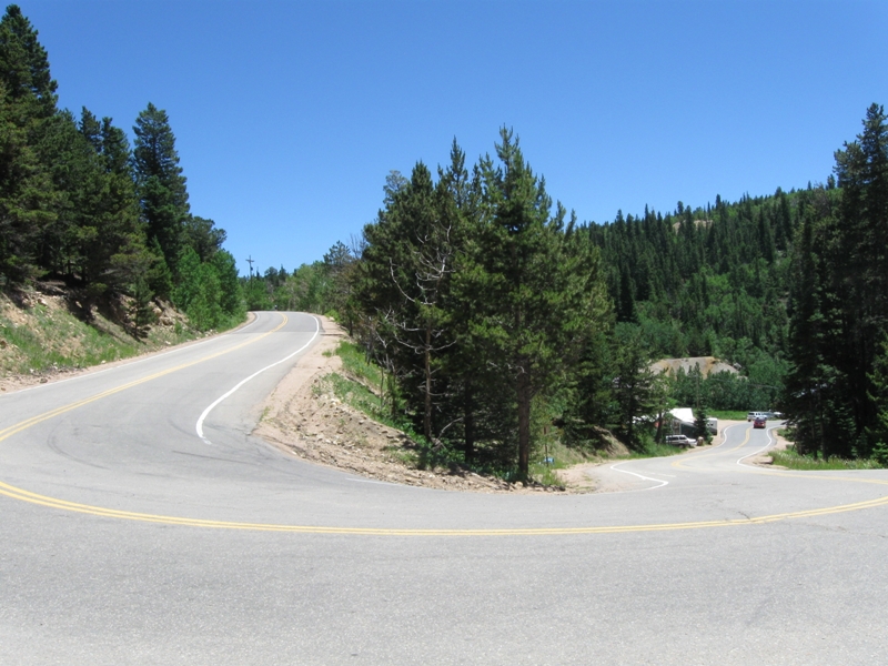
Lefthand Canyon/Ward Road
________________________________________________
Total elevation - 3,361ft Length - 14.4 miles
Average Grade - 4.4% (12%) Rating - 1.77 (cat 1)
________________________________________________
Tame to start, this climb will bite you in its upper sections. From the parking area head up Lefthand Canyon over a moderate grade and some twisty turns. At mile 2.7 turn left on Ward Road (straight for Super James). Ward Road gradually gets steeper as you gain altitude. The last two miles are steeper (this section is broken in two by a small village) and you reach the top through a steep switchback (max grade) as the climb ends at the Peak to Peak Highway at over 9,000 feet.
Directions - From Route 36 just north of Boulder head west on Lefthand Canyon Road for 2.5 miles (Old Stage Road on left) where the climb begins.